Real-time weather observations of the Pamlico are available from
several weather stations.
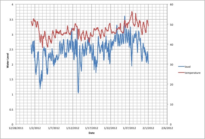
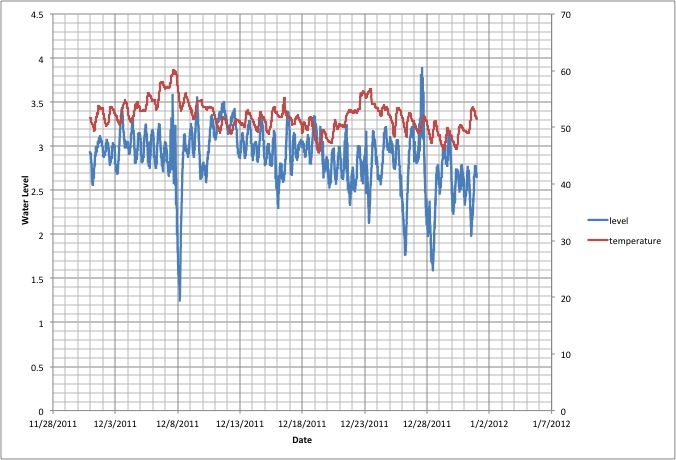
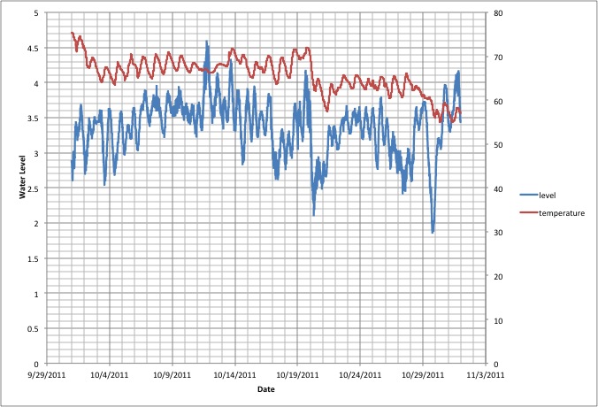
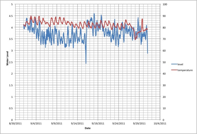
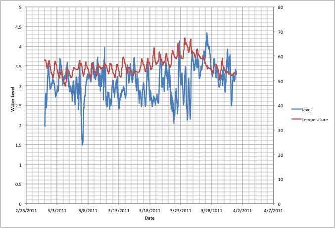
PamlicoRiver.org considers longer-term analysis of water level,
climate and storms. Our own observations are taken with a Davis Vantage Vue weather
station and a Solinst
Levelogger
Gold pressure sensor located on a pier on the Pamlico nearSt.
Clair Creek.
While we hope to eventually consider frequency analysis and
wind/water dynamics, we are currently only prepared to
report water depth and temperature on a monthly basis. Click on
the month to see the report. Since beginning observations on 5
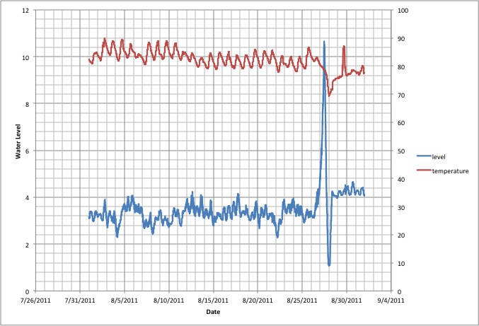
June 2010, the maximum water depth observed was 10.67 feet on
August 27, 2011 during the storm surge of Hurricane Irene. The
next greatest depth was just over 5.4 feet due to the aftermath of
Tropical Storm Nicole on September 30, 2010 and the minimum was
below 1 foot in the rebound of the Irene surge. The next lowest
was 1.14 feet in the early morning of 27 January 2011. The mean
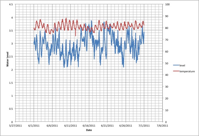
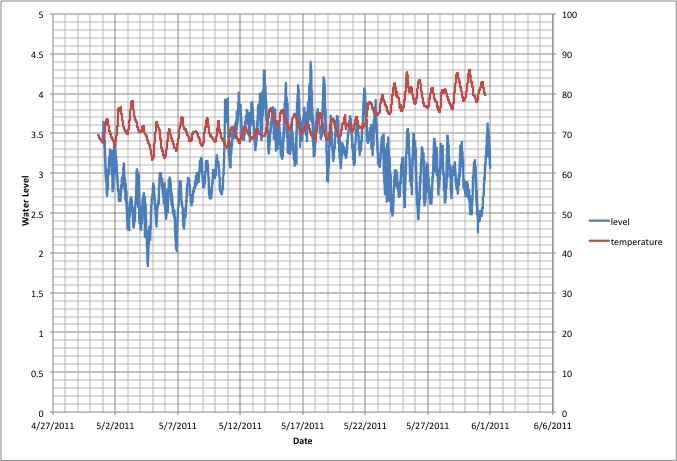
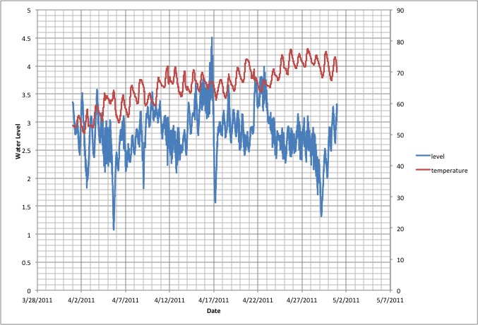
water level for 2011 was 3.07 feet. The water follows a semidurnal
tidal cycle with ~6 inch variation.
Luettich, R.A., S.E. Carr, J.V.
Reynonlds-Fleming, C.W. Fulcher, and J.E. McNinch, 2002, Semi-diurnal
seiching
in a shallow, micro-tidal lagoonal estuary, Continental
Shelf Research, 22, 1669-1681. claim that the clearly evident
semi-diurnal pattern is a standing wave (seiche) in the
Albemarle-Pamlico Estuary System.